
NWF ADV RALLY
The NWFER ADV Rally is a dual sport event navigating the sandy trails of Eglin Reservation looking for checkpoints. This is a team event, so if you sign up as a single, you’ll be required to find a team or we’ll pair you with a team.
The Rally combines elements of navigation, riding skill, and teamwork - for Adventure and Dual Sport Motorcycle enthusiasts.
#NWFER #NWFADVRALLY
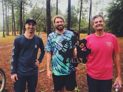
2019 Winners


HOW TO PLAY
Each team (2-4 riders) will receive GPS coordinates with checkpoints spread all over the Eglin AFB Reservation. The checkpoints are split up into 1 and 3 pointers depending on how hard they are to reach, and are all placed at locations of interest.
As you collect the checkpoint locations, you’ll take photos with your smartphone, and upload them to the Facebook Group page. Whether you want to win the challenge or just have an adventure, you’ll enjoy riding and exploring the Eglin Reservation. If you have any questions, please contact the Adventure Rally team on the Contact page.
REQUIREMENTS
Eglin Reservation Permit - buy the $20 recreational pass here
Street Registered Motorcycle, Motorcycle License
GPS or Smartphone with GPS Apps (Avenza, Maprika, OsmAnd, etc)


RULES AND SCORING
Teams prove they’ve reached a checkpoint by taking a photo with the provided “prop” while having either all team members and/or all bikes in each photo. Teams then post that photo to the event Facebook page. Each checkpoint has a value of 1 or 3.
The intent of the NWFER Adventure Rally is to create a fun yet legitimate competition for dual sport / adventure bikes and riders that reward good riding and navigation. All riders will participate as a team. No one is allowed to ride alone. Teams are 2-4 members. Teams must stay together. Checkpoints will not be awarded unless all riders (or all bikes) appear in the picture.
This is not a speed event. Excessive speed, unsafe passing, and dangerous riding of any sort can result in penalties up to and including disqualification. Excessive speed will likely result in failed navigation, offsetting any theoretical advantage.
Checkpoint scoring will be done exclusively on the event page which requires an account and correct use of posting. If a photo does not show the landmark as described in the tutorial video no points will be awarded. Checkpoints are rated as a 1 (one) or 3 (three). 1 (ones) are on pavement, dirt roads or , mixed surfaces or easy two-track. 3 (threes) are off-road, normally 4×4 type routes or trails and potentially require navigating technical situations. The organizers will free roam and observe at or between various checkpoints throughout the day. The schedule for each day must be closely observed, penalties will be applied if the announced schedule isn’t followed. All photos must be uploaded and tagged by TIME PM.
Because there is no determined route, there is no sweep. You need to be self-sufficient to return to base at the end of the day. You will want water, food, tools, tire repair capability, etc. If you break down somewhere we will try to help eventually, but it probably won’t be on a schedule to your liking.
WHEN & WHERE
The Rally will begin at Speck Pond. You may also camp there with a camping permit ($5/night per person.) Loves, McDonald's, Subway, and Hotel (Sleep Inn & Red Roof Inn) are three miles away. There's also a camping store. Loves has large bathrooms with changing and shower area. The event will be held on
Meeting 0700. Roll out 0800. Points submitted by 1400. Riders return by 1600 for awards.
COORDINATES
W 30.6008332 -86.6936903
14.5mm AA Gun 3
W 30.5530834 -86.9214529
AA Gun 3
W 30.4811081 -86.3638485
Boat 3
W 30.5248143 -86.2722327
Broken Concrete Building 1
W 30.5460062 -86.9175209
Bunker 3
W 30.5827308 -86.8829928
Cargo Containers 3
W 30.5527811 -86.9212418
Cargo Trailer 1
W 30.5809651 -86.8616875
Cemetery 3
W30.6393404 -86.4018274
Concrete Ramp 1
W 30.6349626 -86.5254513
Crashed Plane 3
W 30.5355123 -86.3826715
Creek Bridge 1
W 30.5061082 -86.4175814
Creek Table 3
W 30.5078261 -86.2573683
Grave Site 3
W 30.6693777 -86.2630823
Hat Tree 3
W 30.6041488 -86.7962831
Helicopter 3
W 30.5816890 -86.5752720
Hippy Hole 1
W 30.5716115 -86.8965665
Swamp Jet 3
W 30.5920290 -86.8735601
Jet 3
W 30.5954534 -86.8724752
Oil Tanker 3
W 30.6581774 -86.7038737
Bombed Truck 1
W 30.5042638 -86.3668256
Planes Behind Fence 3
W 30.5360309 -86.5653030
Rest Area 1
W 30.5118653 -86.9377536
Tank 1
W 30.4977674 -86.9286176
Tank 3
W 30.5990108 -86.8123454
Light Armored Vehicle 3
W 30.7333200 -86.3269165
Tank Pad 1
W 30.7372037 -86.2708665
Toilet 3
W 30.5987756 -86.8668867
Trench Bunkers 3
W 30.6008030 -86.6943290
Sherman Tank 3
W 30.7063580 -86.4407550
Bridge Out sign letters must be visible 3
W 30.6955720 -86.4714190
Jr. Walton Pond 1
W 30.6948080 -86.5264340
State Prison sign 1
W 30.6871800 -86.5718870
Florida hiking Trail Head sign 1
W 30.6709630 -86.6333210
Duck Pond Dock 1
W 30.6713050 -86.6662230
Urban Assualt Course sign 1
W 30.7108400 -86.5707260 Fuel
W 30.5121480 -86.4479370 Fuel
W 30.5349280 -86.4931580 Fuel
W 30.4616410 -86.6277950 Fuel
W 30.5949640 -86.9417170 Fuel
W 30.4527940 -86.9080520 Fuel
